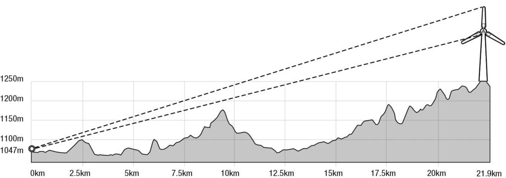
Google Earth profile line from Walcha roundabout, cnr Fitzroy and Derby Street to centre of Winderbourne Wind project, with wind towers (230m high) drawn at the same vertical scale. Multiple flashing red lights at top of every tower will be visable to all of Walcha township all night. While this line of sight is to some of the farthest turbines of the project, there are turbines located as close as 6.5km to the central roundabout in Walcha. Elevation at roundabout is 1047m, elevation at project area av. 1250m. Tower height 230m at blade tip. This is not a visual trick.
Can our roads handle this much impact from this project?